
Astronomers extended Earth’s geography onto the celestial sphere.
For thousands of years, before maps could tell us where we were on Earth, the sky served as a coordinate system. Astronomers extended Earth’s geography onto the celestial sphere. Earth’s equator becomes the celestial equator, and the direction of Earth’s rotation axis defines the celestial poles.
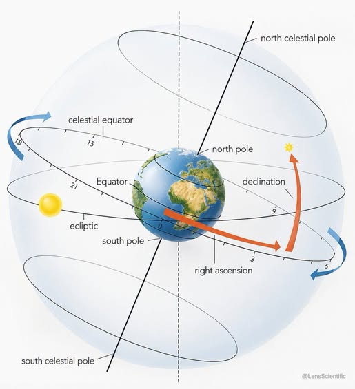
A star’s position is then described using two coordinates:
Right ascension tells you where an object lies eastward along the celestial equator, measured in hours from 0 to 24.
Declination tells you how far north or south the object lies from the celestial equator, measured in degrees.
The ecliptic is different. It is the apparent yearly path of the Sun across the sky, and its tilt relative to the celestial equator comes from Earth’s roughly 23.4° axial tilt. Together, right ascension and declination give astronomers a fixed way to specify where objects are in the sky, much like longitude and latitude locate places on Earth.
See less

Leave a Reply
You must be logged in to post a comment.